Civil Division: Clay Twp
County: Saint Clair
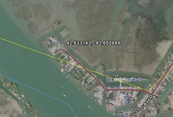
Coordinates: Lat:42.633143, Lon:-82.650999
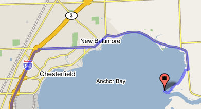
Take the I-94 E ramp to Port Huron - go 15 mi
Take exit 243 to New Baltimore (M-29)/Algonac - go 0.5 mi
Turn right at 23 Mile Rd - go 3.8 mi
Continue on Green St - go 2.1 mi
Continue on Dixie Hwy - go 5.0 mi
Continue on Dyke Rd - go 1.0 mi
Turn right at Anchor Bay Dr - go 2.5 mi
Town, Range, Section: 02N, 15E, 02
Waterbody: Lake Saint Clair
Surface Area (Acres):
Site Rules:
(1) Site Closed 11:00 p.m. to 4:00 a.m.
(2) Fee charged for use of a boating access site administered by Parks and Recreation Bureau.
(3) Site closed to all swimming, wading, and bathing.
Ramp Description:
A hard-surface ramp with sufficient water depth and lake or impoundment size to accommodate